One popular spot in the Peak District is Mam Tor. There are many ways to reach the summit of this impressive hill. Walk from nearby Castleton. You can also include Perveril Castle via the limestone way. Alternatively, simply park in the car park, which is a 5-minute walk from the summit.
Mam Tor which means mother hill, is named for its landslides. These create smaller lumps and can be seen clearly when exploring. These mini hills look like the offspring of the tor itself. It was also used as a hill fort in a past life. Evidence of this can be seen clearly as you walk to the top of the hill.

Mam tor is a popular destination for the sunset/sunrise views and can get incredibly busy at these times. The sun rises over nearby Castleton. This can also include cloud inversions in the early hours of the day. It sets over in the Manchester direction. There can be a dramatic golden hour as it disappears behind the hills.

Humans vs Nature.
One of the old roads leading down into Hope Valley was a victim of a landslide. This landslide gives the tor its name. Known now as ‘Old Mam tor road’, this was once the main route down to Castleton. It had a much steadier gradient than the current road running through Winnats pass.
The road closed in 1979. It became too difficult to repair. Now, it is mostly a car park and walking spot. It can be traversed on foot but there is no chance of getting up in a standard vehicle. The Current route down is stunningly beautiful. It is however, not that friendly to vehicles and knees.
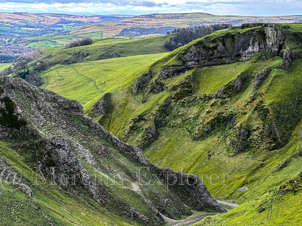
The Road leading through the pass down to Castleton averages at 20% gradient. It is nonetheless, a spectacular experience for the first time and never really gets old. I have passed though here many times both up and down. My car may hate it but I enjoy the drive.

Leave a comment